Introduction | From Haukaladur to the North | Whale sightings in Eyjafjörður | Djúpivogur | Kirkjubæjarklaustur | KATLA | Southern coast | REYKJAVÍK | Grundarfjörður | REYKJANES
Introduction
Iceland is an island of volcanic origin. It owes its formation to the particularly intense volcanic activity in this region. This is caused on the one hand by plate tectonics, or more precisely, by ocean floor spreading due to the drifting apart of the North American Plate and the Eurasian Plate as a result of the opening of the North Atlantic from the late Mesozoic era onwards. The spreading rate of both tectonic plates is around one to two centimetres per year. This results in the promotion of magmatic melts and the associated constant formation of new oceanic crust in the spreading zone. The Mid-Atlantic Ridge is the result of continuous magma promotion at this junction. The highest elevations along the Mid-Atlantic Ridge appear as islands. These include Jan Meyen and the Azores, as well as Iceland. Iceland is one of the few, if not the only, places in the world where the rift system associated with such a divergent plate boundary comes to the surface. Starting from the Reykjanes Peninsula in the southwest – where the boundaries of both tectonic plates are particularly impressive, as they are in Þingvellir National Park – the rift system runs roughly northeast. Thus, the Icelandic landmass is divided between the two tectonic plates.
The so-called ‘plume model’ also suggests that the high volcanic activity – Iceland is one of the most active volcanic regions on Earth with around 30 volcanic systems – can be attributed not only to ocean floor spreading but also to a so-called mantle diapir. Mantle diapirs (‘plumes’) are quasi-stationary, mushroom-like structures integrated into mantle convection, with a diameter of up to several hundred kilometres in the lower part, which allow melt to rise from the Earth's mantle into the lithosphere. Since they are not necessarily bound to constructive (divergent) or destructive (convergent) plate boundaries, plumes typically form volcanic hotspots far away from any plate boundaries, known as intraplate volcanism. The Hawaiian Islands, the youngest members of the so-called Hawaii-Emperor chain, resulting from the constant drift of the Pacific Plate over the sublithospheric hotspot, are a well-known example of this. It is believed that the centre of the Icelandic plume is now located beneath the Vatnajökull ice sheet. The large amounts of melt produced in connection with the plume are probably also the reason why Iceland is not being torn apart despite its location on the Mid-Atlantic Ridge. Instead, the island is growing in an east-west direction by about two centimetres per year. With a maximum age of around 20 million years, Iceland is geologically speaking a relatively young formation. The oldest, predominantly basaltic rocks are found in the north-west and east of the island. In the interior of the island, near or within the active rift zones, lies the youngest bedrock, some of which is significantly less than 700,000 years old, together with post-glacial lava blankets. Today, the volcanically active zones are home to numerous geothermal areas with their typical features such as hot springs, fumaroles and solfataras.
Despite the omnipresent volcanism, it is often exogenous forces that have shaped Iceland's present appearance. Glaciers in particular have shaped the landscape, as Iceland was almost completely covered by ice during the Pleistocene. Even today, glaciers still cover around 11% of the country's surface area. With an area of almost 8,000 square kilometres, the Vatnajökull ice sheet is Iceland's largest glacier and also the largest extra-polar glacier in Europe. Other large ice caps include Langjökull with an area of approximately 900 square kilometres, Hofsjökull with 890 square kilometres, and Mýrdalsjökull with 560 square kilometres. Smaller glaciers can also be found in the Westfjords (Drangajökull) and on the Snæfellsnes Peninsula (Snæfellsjökull). The glacial impact on the originally flatter relief created steep-sided incisions in the form of trough valleys and fjords. Iceland's glacial heritage also includes glacial polishing of the bedrock and the glacio-fluvial deposits of moraines and sandurs. With Breiðamerkursandur, Mýrdalssandur and Skeiðarársandur, there are three large sandur areas on the south coast of Iceland. Where the glaciers retreat and the hollows they have created are filled with meltwater, glacial lakes or glacial lagoons form. On the southern edge of Vatnajökull, Breiðamerkursandur is home to three such lagoons: Fjallsárlón, Breiðárlón and Jökulsárlón. Of these, Jökulsárlón, with its icebergs floating on the water – these are glacier debris from Breiðamerkurjökull – is the largest and probably also the most beautiful glacier lake in Iceland.
The large ice caps often conceal volcanic systems with their associated calderas, fissures and craters. Bárðarbunga and Grímsvötn, covered by Vatnajökull, are among Iceland's most active volcanic systems. Mýrdalsjökull covers the 100-square-kilometre caldera of Katla. Katla is the central volcano of a 100-kilometre-long system and has historically been prone to comparatively explosive eruptions. Where volcanic eruptions occur under ice cover, characteristic rock formations called hyaloclastites form. Steep-sided but relatively flat table volcanoes (tuyas) and characteristic pillow lavas are also part of the treasure trove of forms created by subglacial volcanism. Fed by precipitation, groundwater, springs and glaciers, flowing waters also shape the Icelandic landscape. The longest rivers in Iceland are Þjórsá and Jökulsá á Fjöllum, each just over 200 kilometres long. Steps on the way to the mouth are overcome by the numerous waterfalls found in Iceland. It is estimated that Iceland has more than 10,000 waterfalls. Among the larger and better-known examples are Dettifoss, Gullfoss, Goðafoss, Seljalandsfoss, and Skógafoss.
The route along which the pictures shown here were taken starts at Keflavík International Airport and leads first to the Haukaladur Valley. The way there takes us through Þingvellir National Park. Located in the middle of the rift valley, the tectonic rift is particularly well illustrated here by a multitude of crevices.

From Haukaladur to the North
Haukaladur is a high-temperature thermal area in the north of Lake Laugarvatn. In 1935, Sigurdur Jónass donated the area to the Icelandic people with the aim of turning it into a national park. Here we encounter the Great Geysir – the namesake of all geysers – and Strokkur. While the Great Geysir erupts only very rarely, Strokkur is very active and shoots a 20 to 30 metre high column of boiling water into the sky at intervals of about 10 minutes.


From here, continue north along Route 35 – Kjalvegur – towards Akureyri. Today's ford-free Kjalvegur connects the southwest of Iceland with the northwest, crossing the highlands. With a length of about 170 kilometres, it is the second longest highland road on the island. Kjalvegur starts in the south near Gulfoss Waterfall, a waterfall on the Hvítá river with two steps, one 11 metres and the other 21 metres high. It then skirts Langjökull and Hofsjökull and crosses the Hvítá near the glacial lake Hvítárvatn.


Gulfoss


The highlands
The highest point of Kjalvegur is the Fjórdungsalda watershed, at an altitude of 673 metres above sea level, before a branch leads off to the Hveravellir geothermal area. Hveravellir is located approximately halfway between Reykjavík and Akureyri. The high-temperature area features numerous typical phenomena such as solfataras and fumaroles, but sinter terraces can also be found here. A hut offers a place to rest, there is a thermal bath, and numerous hiking trails allow visitors to explore the area. In the northern section from Hveravellir, the Kjalvegur then passes the Blöndulón reservoir before ending near the local hydroelectric power station close to the ring road. This finally takes us to Akureyri.


Hveravellier high temperature geothermal field
Whale sightings in Eyjafjörður
With just under 20,000 inhabitants, Akureyri is Iceland's fourth largest city. Akureyri's origins date back to the year 1000. Today, the port city located at the southern end of Eyjafjörður and only 50 kilometres south of the Arctic Circle is the largest population and service centre outside the capital region. With its location on the ring road, its own airport and its port with a cruise terminal, the city is well connected in terms of transport. Starting from Akureyri, we explore Eyjafjörður. With a length of approximately 70 kilometres, it is the longest fjord in Iceland. It lies between the Tröllaskagi peninsula in the west and Flateyjarskagi in the east, with mountains over 1,000 metres high rising on both sides of the fjord. The slopes drop steeply to the water, especially at the entrance to the fjord. This can be seen particularly well in the village of Grenivík, for example.


Eyjafjörður as viewed from Grenivík
Water, volcanoes, vastness
The journey continues from Akureyri, following the ring road via Goðafoss, Mývatn and Hverir to Djúpivogur in eastern Iceland. At Goðafoss, the waters of the Skjálfandafljót river plunge approximately 11 metres over a width of around 160 metres.


Goðafoss
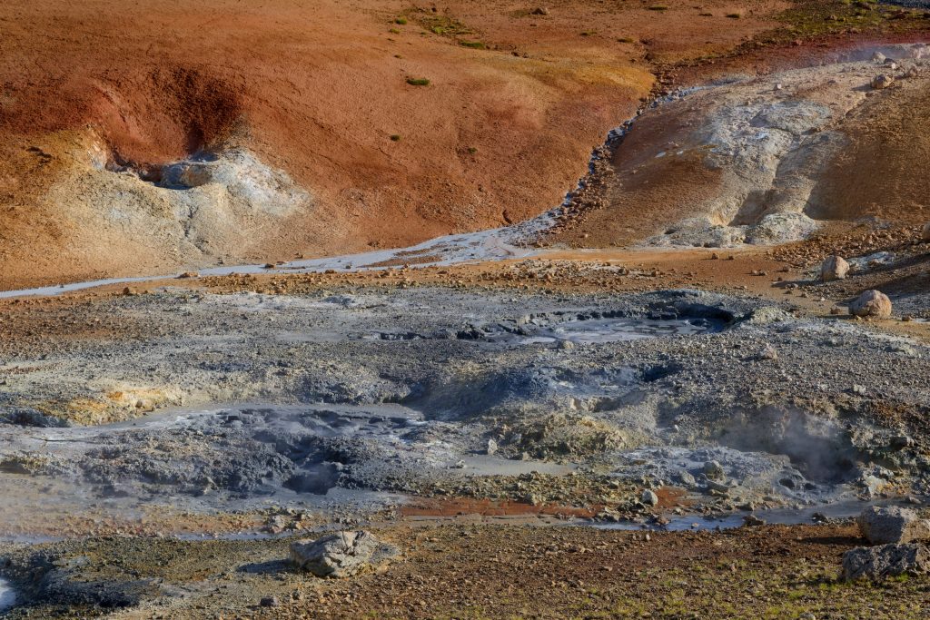
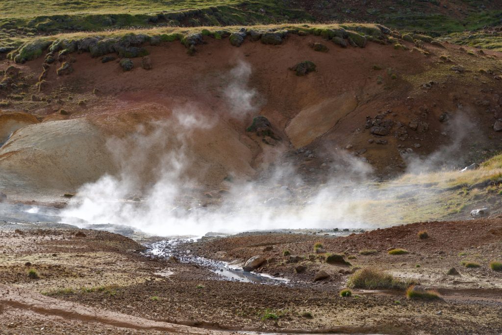
Mývatn is Iceland's fourth largest lake. It covers an area of approximately 37 square kilometres, but with an average depth of around 2 metres, it is extremely shallow. Mývatn is part of the Krafla volcanic system, which is still active today. The Námafjall volcano, which is still active, is crossed here by the Námaskarð Pass. There are geothermal areas both east and west of the pass. We head for Hverir, a high-temperature area located east of Námafjall with numerous hot springs and mud pots.


View over Mývatn; on the Námaskarð Pass and in the Hverir high-temperature area with Námafjall in the background
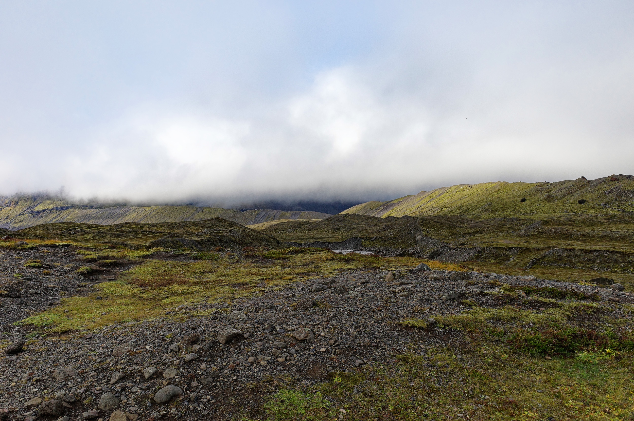
From Námafjall, we head east across the uninhabited Mývatnsöræfi wasteland, which covers a large part of the 4,400 square kilometre Ódáðahraun lava field, until we reach Jökulsá á Fjöllum and finally Egilsstaðir. With 2,500 inhabitants, Egilsstaðir is the largest town in eastern Iceland. The last part of the route leads from here in a south-easterly direction, past Lagarfljót and following the Axará over the Öxi Pass. The descent to Djúpivogur, which is particularly steep in the last section, offers spectacular views of the Berufjörður fjord and the Folaldafoss waterfall below.

Mývatnsöræfi wilderness, Beitarhúsið as one of the few rest stops on the ring road in this part of Iceland


Öxi Pass shortly before reaching Berufjörður, Folaldafoss, sunset at Djúpivogur
Djúpivogur is an old village with a few hundred inhabitants. Fishing and tourism dominate, and a striking feature is the trading house Langabúð.


In and around Djúpivogur
Black beaches & ice
The next stage follows the Ring Road to Kirkjubæjarklaustur and the Katla Geopark. On the way, we stop at Lækjavík and Hvalnes, two black beaches typical of Iceland. At Hvalnes, the black pebble beach, several kilometres long, juts out from the coast as a narrow spit.

On the ring road


Lækjavík and Hvalnes black beaches
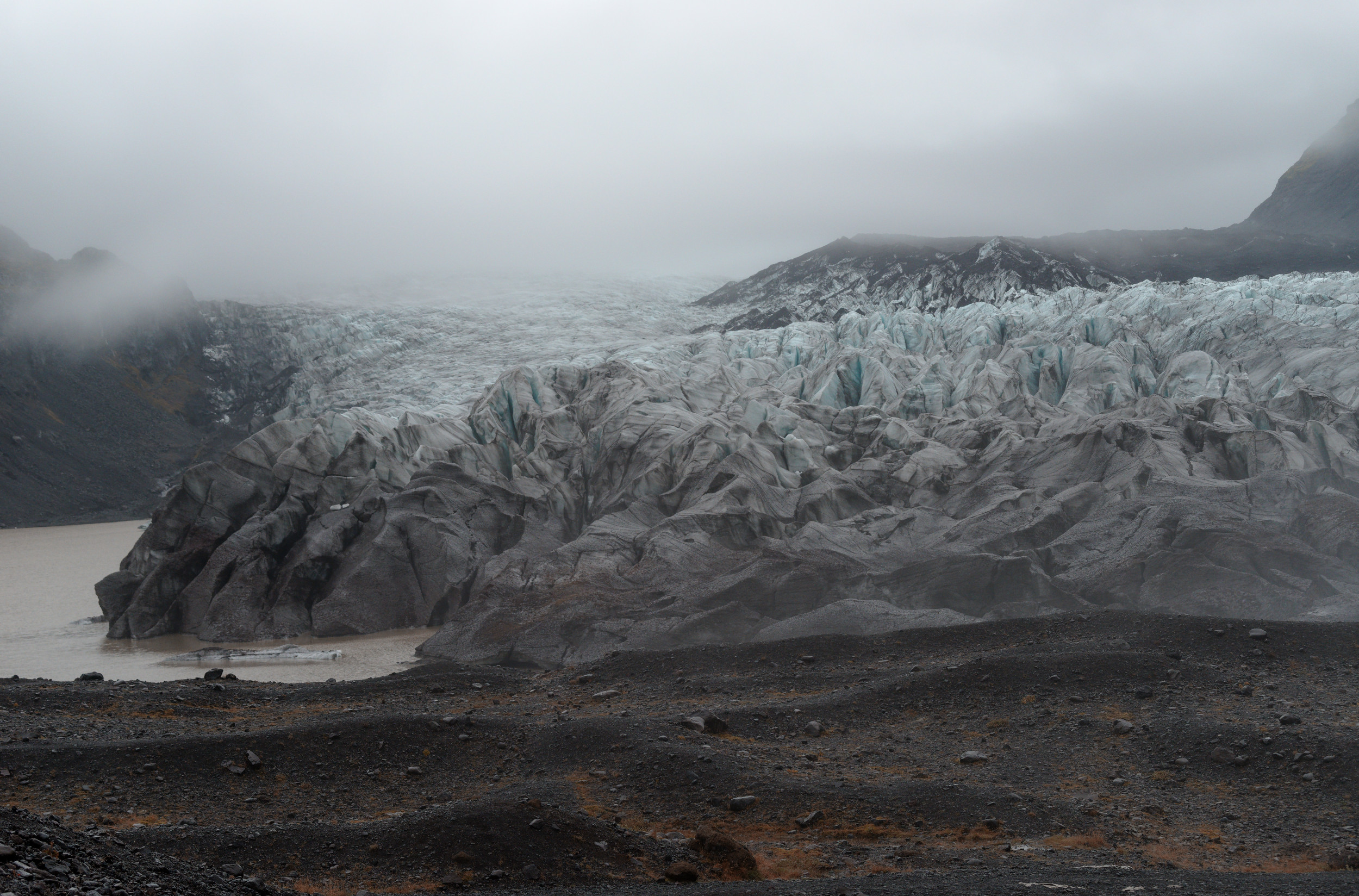
Afterwards, Vatnajökull and its numerous outlet glaciers, i.e. the glacier tongues flowing from the ice sheet, accompany us on our way on the right-hand side. One of these outlet glaciers is Breiðamerkurjökull, whose approximately 18 square kilometre glacial lake Jökulsárlón is a real highlight of this part of the trip.

Icebergs on the Jökulsárlón drift towards the sea
With a depth of 284 metres, Jökulsárlón is Iceland's deepest lake. It is best known for the icebergs floating on it, which have calved from Breiðamerkurjökull, and the seals that live among them. The diverse colours of the ice are impressive, ranging from the blue of highly compacted glacier ice to black, due to impurities and deposits such as volcanic ash. The so-called Diamond Beach is also located in the immediate vicinity. Here, the remains of washed-up drift ice form a striking contrast to the black basalt beach, giving the beach its name.


Breiðamerkurjökull, Jökulsárlón, ice chunks on Diamond Beach
We then make another stop at Kvíárjökull to catch a glimpse of the glacier tongue. At Svínafellsjökull, we visit another glacier tongue of Vatnajökull, which flows downhill from Hvannadalshnúkur, Iceland's highest mountain.


Kvíárjökull Bílastæði


Svínafellsjökull
Katla
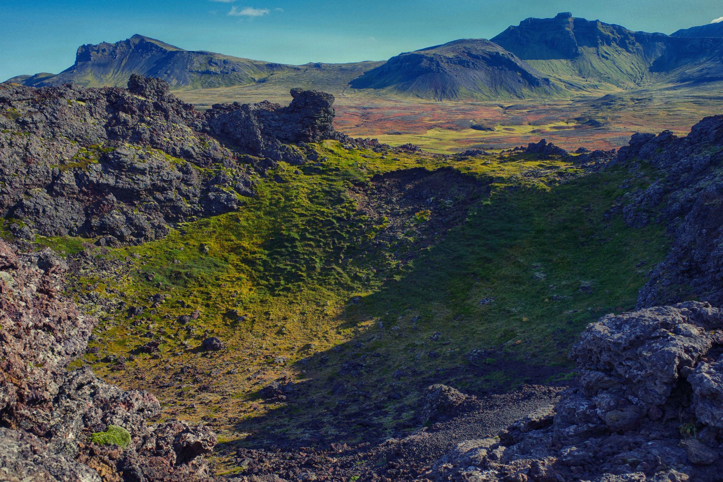
Kirkjubæjarklaustur, a small village with around 200 inhabitants, is one of the starting points for exploring the Katla Geopark. It is located on the glacial river Skaftá. Numerous natural monuments and sights can be found nearby. These include basalt column formations as well as steep-walled canyons and extensive lava fields.


View towards Katla


The transition to the highlands is marked along the coast by a striking cliff face, which corresponds to a former coastline. Numerous basalt column formations such as Dverghamrar or Kirkjugólf, eroded to surface level by glacial grinding, can be seen here.


Fjaðrárgljúfur is a canyon approximately 2 kilometres long, with steep walls along which the Mögáfoss waterfall cascades into the gorge, which is around 30 metres deep.


Eldhraun is a lava field covering over 500 square kilometres, now largely covered by moss. It was formed by the Laki eruption in 1783 and 1784. The eruption, also known as Skaftáreldar, produced an estimated 15 to 20 cubic kilometres of basaltic lava and over 100 million tonnes of volcanic gases. It is considered one of the largest eruptions in historical times and caused crop failures and famine in Iceland, as well as in Europe and North America, known as the ‘volcanic winter’.
The southern coast
From Kirkjubæjarklaustur, we continue via Vík í Mýrdal and Hveragerði to Reykjavík. In Vík í Mýrdal, we first stop at Víkurfjara, Vík í Mýrdal's black sand beach. Here we have a good view of Reynisdrangar, the basalt columns off the beach. We also visit Skógafoss and Sjeljalandsfoss, two waterfalls located below Eyjafjallajökull. Both plunge over approximately 60-metre-high cliffs, which represent the former coastline in the south of Iceland and today mark the transition from the coastal lowlands to the highlands as a striking threshold. At Sjeljalandsfoss, the foot of the rock face is so hollowed out that it is possible to walk around the waterfall.


Black beach in Vík í Mýrdal, floral decorations in the park of Hveragerði


Skógafoss and Sjeljalandsfoss are among the larger and better-known waterfalls in Iceland.
Reykjavík
Upon arrival in the capital city of Reykjavík, by far the largest urban centre in Iceland with 140,000 inhabitants, urban flair dominates. Reykjavík is the northernmost capital of a sovereign state in the world, with almost 40% of Icelanders living in the city. Perhaps the most symbolic landmark is Hallgrímskirkja, which is known for its design inspired by the basalt columns that are common in Iceland. At 74.5 metres high, the Lutheran Protestant church is the tallest building in the city. Reykjavík also impresses with its modern architecture. The Harpa concert hall is one such example. With its glass façade, it contrasts sharply with the traditional architecture. We make a short stop in Reykjavík before heading to Grundarfjörður in western Iceland.

View from the ring road across Kollafjörður to Reykjavík


Going west – Grundarfjörður
Grundarfjörður is located on the Snæfellsnes Peninsula – ‘Snow Mountain Peninsula’. It is bordered by the Breiðafjörður fjord to the north and Faxaflói Bay to the south. At its western tip, in the centre of Snæfellsjökull National Park, lies Snæfellsjökull, a 1,446-metre-high, glacier-covered stratovolcano that last erupted around 4,000 and 1,750 years ago.


On our way to Snæfellsnes.
Near Grundarfjörður lies Kirkjufell, a 460-metre-high peak that has been roughly carved by glaciers and protrudes from the glacial ice as a nunatak. The mountain is one of Iceland's most photographed landmarks.


Kirkjufell, polar lights over Kirkjufell.
From here, we drive via Ólafsvík to Djúpalónssandur, with a stop at the Saxhóll crater. Here, a staircase leads up to the approximately 40-metre-high volcanic crater, where views of the caldera, the vast lava fields, the sea and Snæfellsjökull open up.


Beach with Snæfellsjökull in the background, Ólafsvík church.


Saxhóll crater, view overlooking the caldera, Snæfellsjökull.
Djúpalónssandur was once home to a fishing village, but today it lies abandoned and littered with the wreckage of a fishing trawler that crashed here in 1948. Separated from the sea, we find two small freshwater lagoons here, Djúpulón and Svörtulón. We continue to Arnarstapi, a small fishing village. Here we find a basalt coastline that has been eroded by the sea and is characterised by caves and rock arches. Near Arnarstapi, the 570 begins, perhaps the most beautiful highland road in Iceland. The 19-kilometre road crosses the Snæfellsness Peninsula between Arnarstapi in the south and Ólafsvík in the north, passing close to Snæfellsjökull. Finally, we visit Stykkishólmur, the largest town on the peninsula with 1,300 inhabitants, which lives mainly from fishing.


Djúpalónssandur, Arctic fox and wreckage on the beach, freshwater lagoon.


Basalt coast of Arnarstapi, impressions from the highland road 570.


Stykkishólmur.

Reykjanes
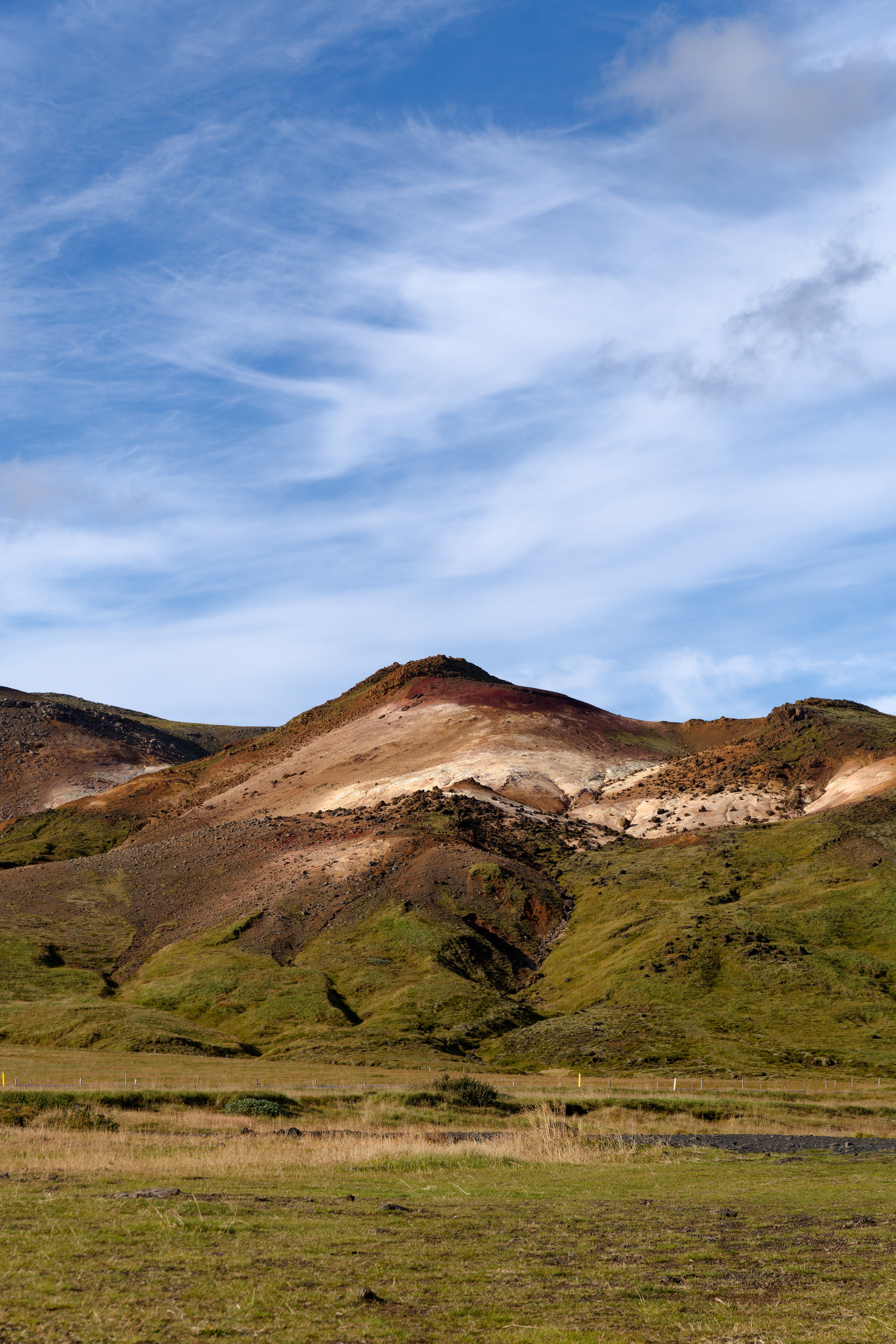
The last leg of our journey takes us from Grundarfjörður back to Keflavík, but on the way we cross the Reykjanes Peninsula, where the Mid-Atlantic Ridge rises to the Earth's surface. The landscape of Reykjanes is characterised by vast lava fields. Due to the numerous geothermal areas and many volcanically active zones, the name ‘Smoky Point’ seems quite apt.
With Krýsuvík, we first head for a high-temperature area. Here we find boiling mud pots and numerous fumaroles, which mark an active volcano. Krýsuvík is located in the middle of the rift valley and is only about 30 kilometres south of Reykjavík. The last major eruption here probably took place around 1340. Recently, however, the area has been characterised by increased activity, which manifests itself in earthquake swarms, among other things, and there have also been minor fissure eruptions recently. In this regard, it is speculated that repeatedly observed water level changes in the neighbouring Lake Kleifarvatn are related to these swarm earthquakes.
From Krýsuvík, our route continues to Svartsengi. Here, the geothermal power station of the same name pumps deep water heated to around 250°C to the surface for electricity generation and district heating. The wastewater is discharged into the surrounding Illahraun lava field, which dates back to an eruption in 1226. The resulting saltwater lake, which covers an area of approximately 5,000 square metres, is now used as a thermal bath. This bath is widely known as Bláa Lónið – ‘Blue Lagoon’. Bathing in the 37°C to 42°C warm, mineral-rich thermal water is known to alleviate various skin diseases. The turquoise blue colour of the water is due to diatoms.
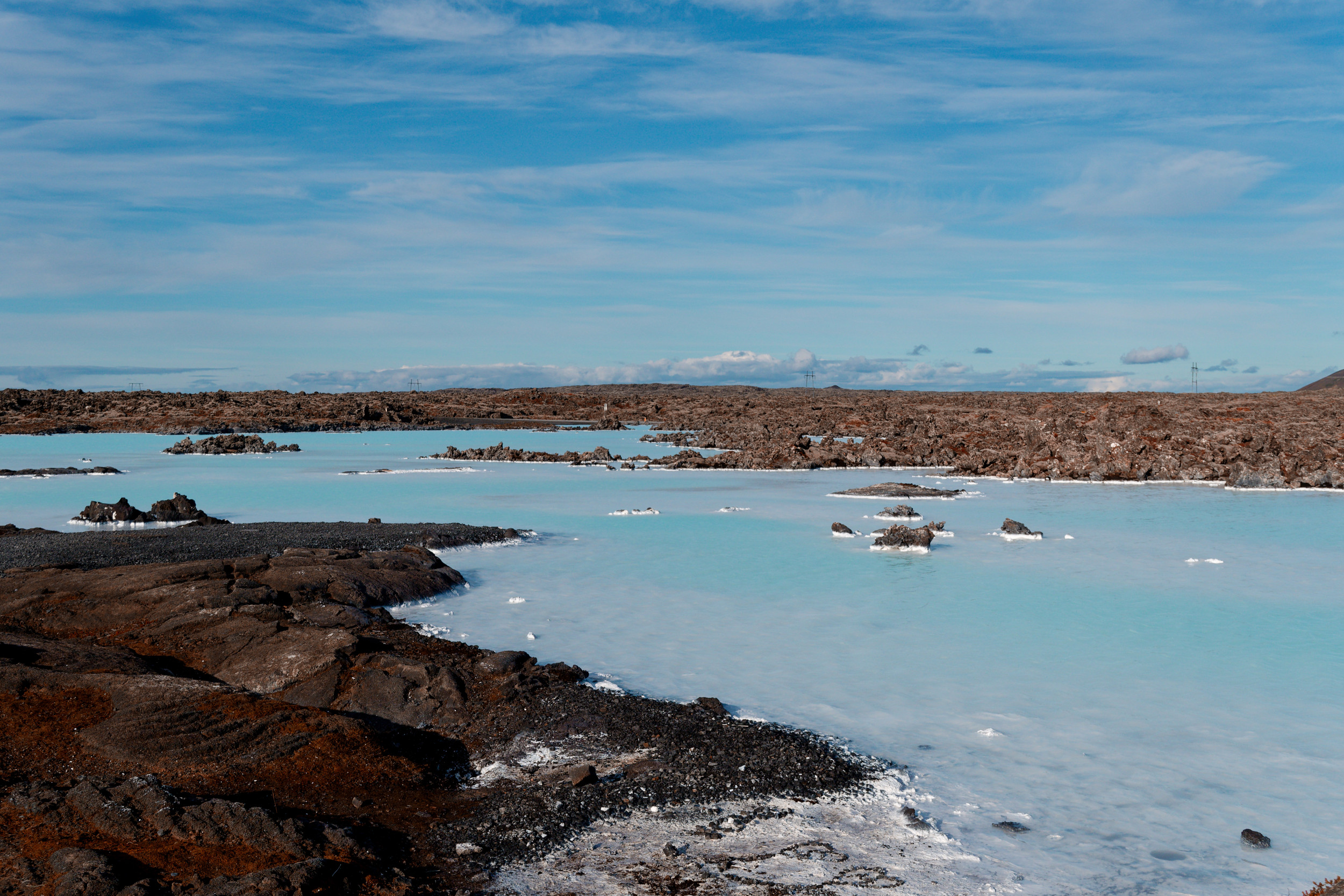
The Blue Lagoon
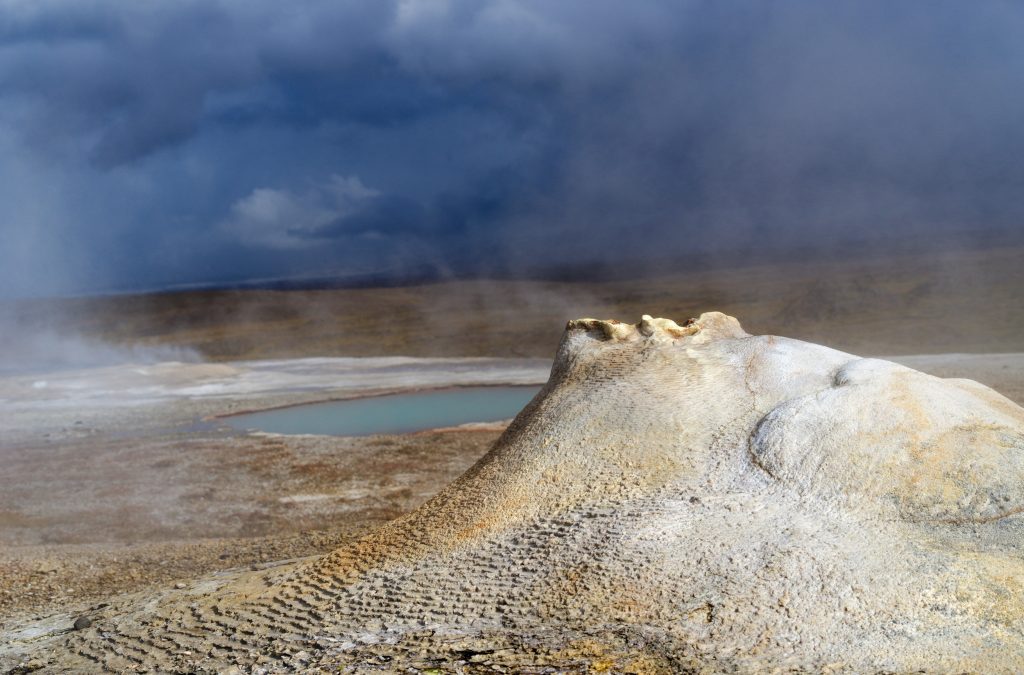
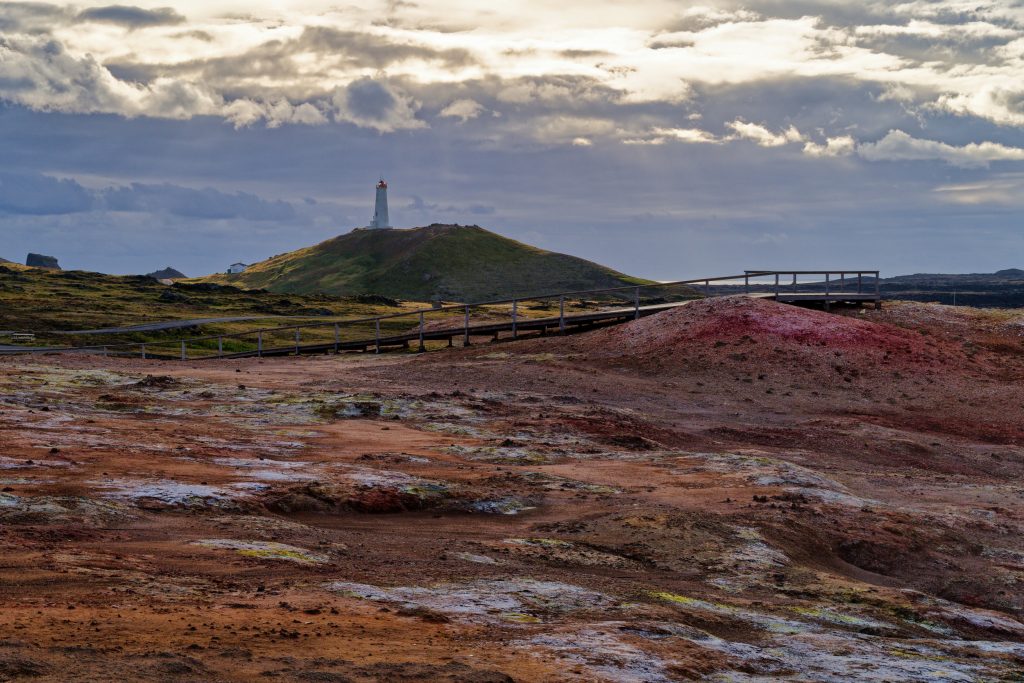
With Gunnuhver, we then visit the high-temperature area of the associated Reykjanes volcanic system, not far from the Reykjanes lighthouse. Gunnuhver is Iceland's largest mud spring area. Since the 2000s, volcanic activity has also been increasing noticeably here, with surface soil temperatures reaching around 300°C.
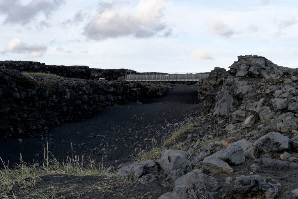
We then visit the Álfagjá fissure, located slightly to the north, which marks the Reykjanes Rift and is part of the boundary between the Eurasian and North American continental plates. The pedestrian bridge Brú milli Heimsálfa – Bridge between the Continents – spans the approximately 20-meter-wide and 7-meter-deep rift, allowing a symbolic crossing from the “old” to the “new” world. We visit the fishing town of Sandgerði before returning to Keflavík Airport, where our journey comes to an end.